|
|
Post by Dale Martens on Aug 18, 2003 2:20:39 GMT -6
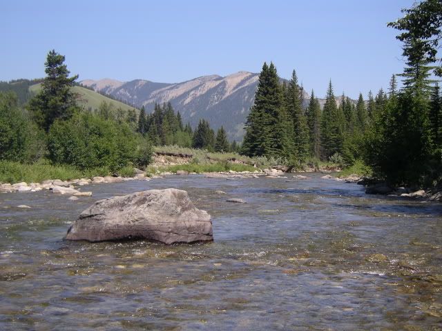
Has anyone ever got anything out of the Brokenhead River?
Went there pretty regularly as a kid - never caught anything but I hooked a couple and there used to be schools of trout visible in the pool between the highway.
I tried it a couple years ago in early July and got nothing - not even a sniff. It sure seemed like it could support some significant trout; the water was clear and cold and the flow was pretty good, too.
|
|
|
|
Post by flyguy on Aug 19, 2003 20:33:11 GMT -6
Anyone know of any good spots along the brokenhead? What else is in there besides the stocked trout? Any ideas?
|
|
Robert Burton
Fly Fishing Zombie
Eventually all things merge into one, and a river runs through it.
Posts: 4,744
|
Post by Robert Burton on Aug 20, 2003 7:21:53 GMT -6
ON the Brokenhead @ highway #1 i haven't even seen a fish but up at #44 there are alot of guys fishing and i hear reports of the usual manitoba fish coming outta there.
|
|
|
|
Post by RandyH on Aug 20, 2003 9:32:37 GMT -6
last time (2 weeks ago) i crossed it at #1, the flow seemed almost non-existant. Doesn't appear to be anyway fish could survive in that section of the river visible from the TransCanada. When you cross the Brokenhead going north to Reynolds Ponds, the flow seems much better; however, there doesn't appear to be any way to fish that section as the river cuts through extremely thick brush that grows right to the water's edge.
|
|
Robert Burton
Fly Fishing Zombie
Eventually all things merge into one, and a river runs through it.
Posts: 4,744
|
Post by Robert Burton on Aug 20, 2003 9:54:24 GMT -6
Does anyone have a topo for that area??
|
|
|
|
Post by darrellmyskiw on Aug 20, 2003 11:53:09 GMT -6
does anyone have a topo  of course I do ;D let me dig it up and I'll post it in the maps area. From memory: - the Brokenhead flip-flops from running water to swamp from the time it crosses hwy 15 - south of the #1, there is a road running parallel to the #1 - it's a couple hundred meters south. This road, when it hits the Brokenhead, turns and runs south along the river. - you have to pick this road up a few klicks west of the Brokenhead - you can get onto the road at Richer, however, I think you may be able to pick it up a bit further east - it stays a river for a ways south of the #1 before turning back into swamp again. hold one....... darrell |
|
|
|
Post by RandyH on Aug 20, 2003 11:59:16 GMT -6
This road south of #1- would that be the old Dawson Trail?
|
|
|
|
Post by darrellmyskiw on Aug 20, 2003 12:05:47 GMT -6
I'm not sure if its the Trail - haven't been down there - I have the area targeted for going - but I can just recall the gravel road being there on the topo With all these Q's and interest about the Brokenhead - seems like we (ok - at least me) have a mission - find out what this water is like. (I kind of like these missions - to boldly go . . . . somewhere)  |
|
|
|
Post by darrellmyskiw on Aug 21, 2003 9:00:05 GMT -6
It's there  chunk of topo map in the maps section  Due to clarity  I highlited: - #1 hwy - FR13 - gravel road (Dawson Trail ?) in red. And I highlited Brokenhead River in blue. darrell, |
|
|
|
Post by shrek on Sept 30, 2003 18:52:45 GMT -6
Hey just thought I would give some info......I live by Beausejour (the brokenhead is nearby).....In the spring there is lot's of sucker, walleye (as long as there is no nets at mouth), and plenty of jack(small though). I know of guys that have got alot of walleye and sauger in the spring by the Kenbro Park area of the river. Apparently some have gotten trout this far up but I have yet to see one that anybody has caught. If you go upriver from Kenbro Park there are some good holes and structured areas to fish. I have alot of fun with a deerhair mouse catching pike.
|
|
|
|
Post by flyguy on Sept 30, 2003 23:03:43 GMT -6
Hey Shrek,
I am wondering what the brokenhead is like in the fall in the Beausejour area??
I checked out, Great woods park yesturday, quite a bit of flow.
Where is Kenbro Park?
|
|


 of course I do ;D
 chunk of topo map in the maps section
 I highlited: